Trio of storms threatens nearly every weather hazard, including ‘life-threatening’ debris flows in LA fire burn areas – CNN
Editor’s Note: This story is no longer being updated. Read our latest story for news on all of the winter storms.
As California prepares for heavy rain in areas recently burned by wildfires, the first of three storms expected in the US this week impacted communities from the Ohio Valley east to New Jersey.
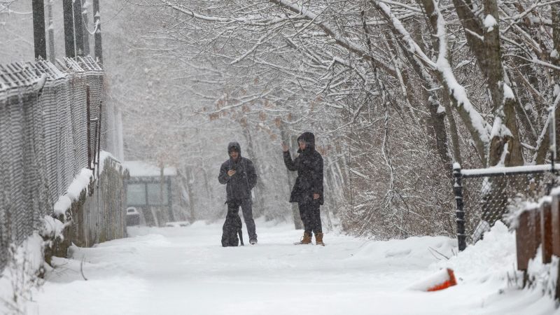
Rain, snow and sleet fell across a 1,500-mile stretch of the eastern US Tuesday, with more than a foot of snow recorded across parts of the Appalachians in Virginia and West Virginia.
The second of back-to-back-to-back winter storms will hit some of the same areas in quick succession Wednesday and dump the most substantial snow of the season over Chicago. The third storm is the most serious flood threat Southern California has faced since January’s devastating wildfires.
Each is another link in a chain of disruptive storms unbroken since the start of February.
Here’s the latest:
• Snowing in DC: Snow began in the mid-afternoon in the nation’s capital and continued overnight. Up to 6 inches of snow will pile up which could snarl travel during the afternoon and evening commute. As much snow as the past two winters combined has already fallen in Washington, DC, this winter.
• Snow is piling up: Snow fell from Kentucky to the Mid-Atlantic Tuesday afternoon. Widespread snow totals of 3 to 6 inches have already coated areas from central Kentucky to western Virginia. Around 1 to 3 inches has fallen farther east in Virginia. There’s more to come into Wednesday morning as the storm tracks east.
• Power outages and treacherous travel likely: Significant amounts of ice – more than 0.25 inches – are possible through Wednesday in parts of West Virginia, Virginia and North Carolina. “Ice accumulations could make many roads treacherous and impassable,” the National Weather Service warned Tuesday. “The weight of ice on tree limbs and power lines could produce numerous outages.”
Tuesday’s storm is tracking farther south than either of last week’s and putting areas that avoided a wintry mess right in the thick of it.
Parts of Virginia recorded over a foot of snow, with Iron Gate recording 14.5 inches and Hollins seeing 13.8 inches. West Virginia’s Fairlea saw 13 inches, while Easton, Maryland, and Dover, Delaware, measured 8 and 7.5 inches, respectively.
Heavy snow piled quickly in some areas, including Washington, DC. As many as 1,100 additional workers traveling from North Carolina, Alabama, Kentucky and Ohio were requested by Appalachian Power to help as snow, ice and rain are expected to hit the area, the utility company said Tuesday.
“Ice accumulations over a quarter inch weigh down trees and electric lines, which can cause substantial utility problems,” the company said.
Virginia Gov. Glenn Youngkin declared a state of emergency, and the Virginia Department of Transportation urged residents to “stay off the roads.” There’s been at least 305 crashes reported statewide, with at least 24 of those crashes reporting injuries, according to state police.
The Virginia National Guard staged dozens of soldiers to aid with storm response. Portions of the George Washington Memorial Parkway, a key roadway that runs alongside the Potomac River, is closed because of the weather, the National Park Service said.
Reagan National Airport in Washington, DC, has logged 5.9 inches of snow, contributing to its snowiest season in years, with 14.3 inches so far — more than the last two winters combined. The storm disrupted travel, causing 230 flight cancellations there on Tuesday and 96 more by early Wednesday.
Snow also blanketed parts of Pennsylvania into New Jersey and will affect southern New England Wednesday. New York City will likely see an inch or two of snow.
Montgomery County Public Schools, Maryland’s largest school district, will be closed Wednesday the district announced, citing “forecasts predicting up to six inches of accumulation.” Several school districts in Virginia are also closed Wednesday.
Heavy rain is drenching an area to the south on the warmer side of the storm. There’s a risk of flooding over a wide area of the South through Wednesday. A level 2 of 4 risk is in place for parts of every state from Texas to the Carolinas — including many areas still recovering from Hurricane Helene — during this time, according to the Weather Prediction Center.
The next storm will form in the central US while its predecessor is still bringing snow and ice to the East and rain to the South. Snow, ice and rain are expected in the Plains into Wednesday morning.
Kansas Gov. Laura Kelly issued a state of disaster emergency proclamation on Sunday due to the storm.
The wintry mess will quickly expand Wednesday to encompass much of the Midwest and parts of the Northeast by the evening.
The bulk of the storm will be on the East Coast by Thursday morning with snow and ice blanketing the Northeast and rain falling farther south. Some parts of the East will only have a few hours between when the first storm ends and the second begins.
Widespread rainfall of 2 to 4 inches is expected from east Texas to the western Carolinas through early Thursday. Isolated totals up to 6 inches are possible. Flood watches are in effect for portions of 9 states from Texas to West Virginia and a level 2 of 4, slight risk of excessive rainfall covers much of the region as well.
There is also a level 2 of 5, slight chance of severe thunderstorms, including tornadoes, on Wednesday across the Deep South from Louisiana to Georgia.
Snow totals from this storm will be highest in the Plains and Midwest. They could approach double digits in Kansas City, Missouri, on Wednesday — close to double what the city typically gets in all of February.
Double-digit snow is also possible in Chicago Wednesday, which would be enough to be the city’s most substantial so far this season. Just over 7 inches of snow have fallen since December when the city typically records almost two feet by now.
Ice will present a significant problem again just south of where the heaviest snow falls. At least a light glaze of ice — enough to make travel tricky — is possible anywhere from Oklahoma and Kansas through the Ohio Valley and Northeast.
Parts of the Appalachians will get another round of ice from this storm. A few of the locations hit hardest from the first storm might not notice a break between the two storms as icy precipitation slows but doesn’t completely stop Wednesday afternoon.
This storm will reinvigorate rain and thunderstorms in the South Wednesday. Some thunderstorms could turn severe in parts of Louisiana, Mississippi and Alabama starting in the afternoon and a Level 2 of 5 threat is in place.
The storm will largely come to an end by Thursday night.
This storm will be different than the previous two in that it will first slam into California fully formed.
The atmospheric river-fueled storm will pack a significant punch and from the start with rain beginning along much of the state’s coast early Thursday morning. Rain will get heavier throughout the day as it reaches farther inland and spreads over the entire length of the state.
The upcoming storm will be the “most significant” so far this winter in Southern California, Ariel Cohen, a meteorologist with the National Weather Service in Los Angeles, warned Tuesday.
Portions of California’s Los Angeles and Ventura counties – including areas burned by the Palisades and Eaton fires – are under a Level 3 of 4 risk of flooding rainfall Thursday, according to the WPC. More than 35 million in the rest of the state are under a level 2 of 4 risk of flooding rainfall Thursday. The threat area encompasses San Francisco, Sacramento, San Diego and areas in between.
Heavy rain presents an even greater risk to areas burned by recent deadly wildfires. An evacuation warning has been issued for those in “areas within and near the Lake Fire burn scar” in Santa Barbara County, the Sheriff’s office said Tuesday.
“Given the elevated chances for significant debris flows consisting of raging torrents of rockslides and mudslides that can be damaging and even deadly, now is the time to start getting prepared for these potentially dangerous conditions,” Cohen urged.
The Palisades Fire burn scar is projected to receive more than 3 inches of rain, while the Eaton Fire burn zone could see around 4.5 inches, according to the weather service’s Tuesday update.
The threat to the burn scar areas comes as officials are tackling the effort to remove hazardous debris left behind by the fires. Los Angeles County recently bolstered storm preparations by cleaning debris basins, installing concrete barriers, and placing sandbags in fire zones to filter debris and protect storm drains.
More than 7,500 feet of concrete barriers and more than 6,500 sandbags have been deployed to areas burned in the Palisades Fire in case of debris flows, Los Angeles Mayor Karen Bass announced Tuesday.
Thursday’s flood risk will not be confined to areas scorched by wildfires. This storm will dump 1 to 3 inches of rain over the Los Angeles basin and totals could approach 6 inches in the area’s mountains – including burn scars.
“Of course we’re concerned about the Palisades and the burned areas, but this is for all of Los Angeles to be concerned about the rain and the impacts,” Bass implored.
This storm will also bring heavy snow to California’s Sierra Nevada and mountainous areas of the West. It will track east Thursday night and Friday and reach the Plains by early Saturday morning.
A boost of atmospheric energy will reinvigorate the potent storm and significantly expand its size once it reaches the central US. Snow will blast over the Midwest Saturday and reach much of the Northeast by the evening. Some sleet and ice may mix with snow in the Northeast with mainly rain drenching areas farther south Saturday night.
Heavy rain and thunderstorms will dominate the warm side of this storm. Some thunderstorms could become severe, especially in parts of the South. Dangerous thunderstorms can happen at any time of the year – some turned deadly last week in Tennessee.
The large storm will continue to pound the East Coast Sunday before coming to an end by Monday morning. But it may not be the end of a busy winter storm pattern as another storm is possible by the middle of next week.
CNN’s Hanna Park and Stephanie Elam contributed to this report.
© 2025 Cable News Network. A Warner Bros. Discovery Company. All Rights Reserved. CNN Sans ™ & © 2016 Cable News Network.
Source: https://www.cnn.com/2025/02/10/weather/winter-storm-los-angeles-fire-rain-climate/index.html